The United States continues to face growing hurricane risks, with some regions far more vulnerable than others. Florida remains the most hurricane-prone state, followed closely by Texas, Louisiana, and North Carolina. Coastal zones such as South Florida, the Outer Banks, and the Northern Gulf Coast often endure major storms every few years, reinforcing just how exposed these areas are to nature’s extremes.
Among the most dangerous effects of hurricanes is the storm surge — a sudden rise in sea level that can cause severe flooding. Low-lying coastal cities like Miami, New Orleans, Tampa, New York, and Savannah face elevated danger when powerful systems move ashore. In these areas, even a small shift in the storm’s path can mean the difference between minor flooding and catastrophic damage.
But hurricane threats don’t end at the coast. Inland flooding, often overlooked, is responsible for roughly 60% of hurricane-related deaths. As storms move inland, they can release immense amounts of rain over states like Texas, Georgia, and the Carolinas, leading to flash floods and river overflows that devastate communities hundreds of miles from the shoreline.
Experts warn that climate change is amplifying these risks. Warmer ocean temperatures are fueling stronger storms, while rising sea levels make flooding more destructive. Today, major hurricanes are both more frequent and more likely to retain strength after landfall. Resources such as FEMA’s National Risk Index and NOAA’s storm surge maps are helping communities prepare, offering valuable insight into the evolving patterns of these powerful storms.
Related Posts
Sad Obama family news
The Obama family suffered the loss of Marian Robinson, the mother of Michelle Obama. Robinson, who lived in the White House during her son-in-law’s presidency and brought…
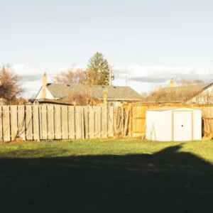
At first, the ‘apology man’ sounded like a kid’s joke, but then I peeked through the fence and uncovered a secret
If you’ve ever gone through divorce, you know too well the toll it takes on you both emotionally and financially. Mine drained me, literally. However, the hardest…

Every Sunday, I got paid to pretend to be a blind veteran’s granddaughter — his final wish changed my entire life
At twenty-two, I was so broke that I took the weirdest job one could ever think of. During the day, I attended classes at college, and right…

Pregnant mistress gets front row at ex’s military funeral, until the general walks right past her
Making three identical meals for my triplets while they teared through the house trying to get ready for school just added to the madness and the chaos…

This morning, I stepped out onto the porch to get some fresh air and discovered this. Honestly, at first, I was really scared.
The morning began like any other until something unusual caught my attention on the porch. Resting against the weathered boards was a small bundle of reddish fur,…

Americans may receive $1,745 payment after Trump promised to give money to almost everyone in America – here’s when it could hit your bank
There is no confirmed official $1,745 payment program currently approved for nearly all Americans. The figure appears in online discussions, but it does not reflect an enacted…